Littleton, Colorado
Littleton, Colorado | |
|---|---|
 Downtown Littleton, 2015. | |
 | |
Location of the City of Littleton in the United States. | |
| Coordinates: 39°36′25″N 105°0′39″W / 39.60694°N 105.01083°W | |
| Country | |
| State | |
| Counties[2] | Arapahoe County Douglas County Jefferson County |
| City[1] | Littleton |
| Settled | 1862 |
| Incorporated | March 13, 1890[4] |
| Named for | Richard Little |
| Government | |
| • Type | Council–manager government |
| • Mayor | Kyle Schlachter [5] |
| Area | |
• Total | 35.63 km2 (13.75 sq mi) |
| • Land | 32.69 km2 (12.62 sq mi) |
| • Water | 2.93 km2 (1.13 sq mi) |
| Elevation | 1,645 m (5,397 ft) |
| Population (2020) | |
• Total | 45,652 [3] |
| • Density | 1,281.92/km2 (3,320.15/sq mi) |
| Time zone | UTC−7 (MST) |
| • Summer (DST) | UTC−6 (MDT) |
| ZIP codes[8] | 80120-80130, 80160-80163 (PO Boxes), 80165, 80166 |
| Area code(s) | Both 303 and 720 |
| FIPS code | 08-45255 |
| GNIS feature ID | 2410845[7] |
| Highways | US 85, SH 75, SH 88, SH 470 |
| Website | littletonco.gov/ |
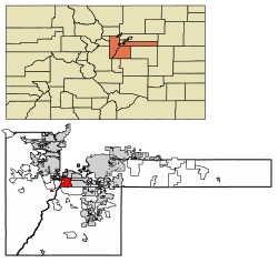
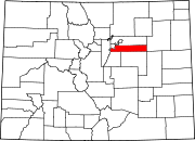
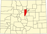
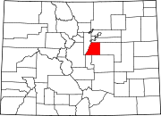
Littleton is a home rule municipality city located in Arapahoe, Douglas, and Jefferson counties, Colorado, United States. Littleton is the county seat of Arapahoe County and is a part of the Denver–Aurora–Lakewood, CO Metropolitan Statistical Area.[10][11] The city population was 45,652 at the 2020 United States Census, ranking as the 20th most populous municipality in Colorado.
History
[edit]The city of Littleton's history dates back to the 1859 Pike's Peak Gold Rush, which brought not just gold seekers, but merchants and farmers to the community. Richard Sullivan Little was an engineer from New Hampshire who came West to work on irrigation systems. Little soon decided to settle in the area at present day Littleton and brought his wife Angeline from the East in 1862. The Littles and neighbors built the Rough and Ready Flour Mill in 1867, which provided a solid economic base in the community. By 1890, the community had grown to 245 people and the residents voted to incorporate the Town of Littleton.[12]
Littleton grew significantly throughout the 1950s and 1960s due to its proximity to Denver and to the Martin Marietta facilities, which produced the Titan rocket and other aerospace products. Littleton is today fully engulfed in metropolitan Denver.
Littleton twinned with Bega, Australia in 1961 as one of the earliest sister cities.
Littleton became widely known in 1999 when the Columbine High School massacre occurred, where two of the school's students, Eric Harris and Dylan Klebold, murdered 12 students and one teacher, injured 23 others and then killed themselves.[13] News media wrongly reported that the incident happened in the city, because the school's ZIP code is primarily associated with Littleton.[14] The school is located in adjacent Columbine, an unincorporated community, which is not a place name accepted by the U.S. Postal Service;[14] by default, locations in ZIP code 80123 use "Littleton" in their mailing addresses.[15] Columbine High School is in the Jefferson County school system and is not one of the Littleton Public Schools.[16][17]
Geography
[edit]Littleton is located in central Colorado north of the junction of U.S. Route 85 and Colorado State Highway 470, the city is 9 miles (14 km) south of downtown Denver and 55 miles (89 km) north of Colorado Springs.[18][19]
Littleton lies on the South Platte River in the Colorado Piedmont region of the Great Plains a few miles east of the Front Range of the Southern Rocky Mountains.[18][20][21] Most of the city lies on the east side of the river. Several small tributaries of the river flow northwest through the city; from north to south, these include Big Dry Creek, Slaughterhouse Gulch, Lee Gulch, and Dad Clark Gulch. In addition, several small lakes and reservoirs are located along the river in the southwestern part of the city. Immediately west of the river are Cooley Lake, Bufflehead Lake, South Platte Reservoir, Eaglewatch Lake, Redtail Lake, and Blackrock Lake. Wolhurst Lake and McLellen Reservoir are east of the river, fed and drained by Dad Clark Gulch. Chatfield Reservoir lies immediately southwest of the city.[18]
According to the United States Census Bureau, the city has a total area of 13.87 square miles (35.9 km2) of which 12.98 square miles (33.6 km2) is land and 0.89 square miles (2.3 km2) (6.4%) is water.[22]
As a suburb of Denver, Littleton is part of the Denver-Aurora metropolitan area and the Front Range Urban Corridor.[23] It shares a border with Denver and Englewood on the north, Greenwood Village on the northeast, Centennial on the east, Highlands Ranch on the south, Columbine and Columbine Valley on the west, and Bow Mar on the northwest.[22]
Unlike most county seats of suburban counties, Littleton is on the same house numbering grid, including its downtown, as the major city, in this case, Denver.
Climate
[edit]| Climate data for Littleton, Colorado (Elevation 5,310ft) | |||||||||||||
|---|---|---|---|---|---|---|---|---|---|---|---|---|---|
| Month | Jan | Feb | Mar | Apr | May | Jun | Jul | Aug | Sep | Oct | Nov | Dec | Year |
| Record high °F (°C) | 78 (26) |
76 (24) |
86 (30) |
88 (31) |
90 (32) |
98 (37) |
99 (37) |
98 (37) |
94 (34) |
88 (31) |
82 (28) |
76 (24) |
99 (37) |
| Mean daily maximum °F (°C) | 43.8 (6.6) |
47.2 (8.4) |
53.9 (12.2) |
62.6 (17.0) |
69.4 (20.8) |
80.3 (26.8) |
85.4 (29.7) |
82.7 (28.2) |
75.4 (24.1) |
64.1 (17.8) |
51.0 (10.6) |
43.0 (6.1) |
63.2 (17.3) |
| Mean daily minimum °F (°C) | 15.3 (−9.3) |
19.1 (−7.2) |
27.7 (−2.4) |
35.1 (1.7) |
43.4 (6.3) |
52.6 (11.4) |
57.6 (14.2) |
55.8 (13.2) |
46.6 (8.1) |
33.7 (0.9) |
22.8 (−5.1) |
15.0 (−9.4) |
35.4 (1.9) |
| Record low °F (°C) | −20 (−29) |
−23 (−31) |
−5 (−21) |
6 (−14) |
21 (−6) |
36 (2) |
44 (7) |
42 (6) |
17 (−8) |
2 (−17) |
−2 (−19) |
−29 (−34) |
−29 (−34) |
| Average precipitation inches (mm) | 0.36 (9.1) |
0.47 (12) |
1.44 (37) |
1.50 (38) |
2.75 (70) |
1.88 (48) |
1.89 (48) |
1.99 (51) |
1.09 (28) |
1.23 (31) |
1.14 (29) |
0.64 (16) |
16.39 (416) |
| Average snowfall inches (cm) | 8.9 (23) |
7.8 (20) |
11.9 (30) |
7.8 (20) |
0.6 (1.5) |
0 (0) |
0 (0) |
0 (0) |
0.9 (2.3) |
3.0 (7.6) |
12.2 (31) |
12.7 (32) |
65.7 (167) |
| Source: The Western Regional Climate Center[24] | |||||||||||||
Demographics
[edit]| Census | Pop. | Note | %± |
|---|---|---|---|
| 1880 | 100 | — | |
| 1900 | 738 | — | |
| 1910 | 1,373 | 86.0% | |
| 1920 | 1,636 | 19.2% | |
| 1930 | 2,019 | 23.4% | |
| 1940 | 2,244 | 11.1% | |
| 1950 | 3,378 | 50.5% | |
| 1960 | 13,670 | 304.7% | |
| 1970 | 26,466 | 93.6% | |
| 1980 | 28,631 | 8.2% | |
| 1990 | 33,685 | 17.7% | |
| 2000 | 40,340 | 19.8% | |
| 2010 | 41,737 | 3.5% | |
| 2020 | 45,652 | 9.4% | |
| U.S. Decennial Census[25] | |||
As of the 2010 census, there were 41,737 people, 18,312 households, and 10,724 families residing in the city. The population density was 3,215.5 inhabitants per square mile (1,241.5/km2). There were 19,176 housing units at an average density of 1,497.2 units per square mile (578.1 units/km2). The racial makeup of the city was 89.0% White, 2.2% Asian, 1.4% African American, 0.8% American Indian, 0.1% Pacific Islander, 3.9% from other races, and 2.6% from two or more races. Hispanics and Latinos of any race were 12.4% of the population.[26]
There were 18,312 households, out of which 27.1% had children under the age of 18 living with them, 44.8% were married couples living together, 4.3% had a male householder with no wife present, 9.5% had a female householder with no husband present, and 41.4% were non-families. 34.7% of all households were made up of individuals, and 12.4% had someone living alone who was 65 years of age or older. The average household size was 2.25, and the average family size was 2.93.[26]
The distribution of the population by age was 21.6% under the age of 18, 7.7% from 18 to 24, 25.6% from 25 to 44, 29.3% from 45 to 64, and 15.8% who were 65 years of age or older. The median age was 41.3 years. The gender makeup of the city was 48.3% male and 51.7% female.[26]
The median income for a household in the city was $54,512, and the median income for a family was $74,744. Males had a median income of $52,674 versus $40,297 for females. The city's per capita income was $33,889. About 7.4% of families and 11.0% of the population were below the poverty line, including 13.8% of those under age 18 and 9.0% of those age 65 or over.[26]
Economy
[edit]As of 2013, 66.8% of the population over the age of 16 was in the labor force. 0.1% was in the armed forces, and 66.7% was in the civilian labor force with 61.2% employed and 5.5% unemployed. The occupational composition of the employed civilian labor force was: 44.4% in management, business, science, and arts; 25.0% in sales and office occupations; 17.8% in service occupations; 6.6% in production, transportation, and material moving; 6.2% in natural resources, construction, and maintenance. The three industries employing the largest percentages of the working civilian labor force were: educational services, health care, and social assistance (20.1%); professional, scientific, and management, and administrative and waste management services (14.1%); retail trade (11.2%).[26]
The cost of living in Littleton is average; compared to a U.S. average of 100, the cost of living index for the community is 101.8.[27] As of 2013, the median home value in the city was $269,000, the median selected monthly owner cost was $1,668 for housing units with a mortgage and $470 for those without, and the median gross rent was $902.[26]
Government
[edit]

Littleton is a home-rule municipality with a council-manager form of government. The city council makes policy for the city and approves the annual city budget. The city manager implements the council's policies and oversees day-to-day administration of the city government and its departments.[28]
As the county seat, Littleton is the administrative center of Arapahoe County. The county government's main Administration Building is located in Littleton, and most county government departments base their operations in the city.[29]
Littleton lies mostly within Colorado's 6th U.S. Congressional District, but changes made to Colorado's congressional districts in 2012 put the extreme southwestern portion of the city into Colorado's 1st congressional district.[30] For the purposes of representation in the Colorado General Assembly, the city is located in the 26th and 30th districts of the Colorado Senate and the 3rd, 38th, and 43rd districts of the Colorado House of Representatives.[31]
Elected officials
[edit]The council consists of seven members - one member for each of the four legislative districts, two at-large members, and the mayor.[32] Beginning in 2021, all council members are elected to 4-year terms. General elections for city council are held in odd-numbered years with either three or four council seats up for election. In 2021, Littleton voters elected the first popularly-elected mayor to a four-year term.
| Member | District | Term |
|---|---|---|
| Kyle Schlachter | Mayor (at-large) | 2021-2025 |
| Gretchen Rydin | At-large | 2021-2025 |
| Pam Grove | At-large | 2023-2027 |
| Patrick Driscoll | District 1 | 2021-2025 |
| Robert Reichardt | District 2 | 2023-2027 |
| Stephen Barr | District 3 | 2021-2025 |
| Andrea Peters | District 4 | 2023-2027 |
| Mayor | Term |
|---|---|
| Franklin S. Gilmore | 1890–1891 |
| Dr. D.S. Weaver | 1891–1892 |
| H.H. Shepperd | 1892–1893 |
| J. Vanatta | 1893–1894 |
| G.M. Benedict | 1894–1895 |
| H.H. Shepperd | 1895–1896 |
| G.M. Benedict | 1896–1897 |
| C.H. Barclay | 1897–1898 |
| H.H. Shepperd | 1898–1901 |
| C.W. Sittser | 1901–1902 |
| Dr. J.A. Farnsworth | 1902–1905 |
| R.F. Gill | 1905–1906 |
| H.H. Shepperd | 1906–1908 |
| Dr. W.C. Crysler | 1908–1910 |
| J.E. Maloney | 1910–1912 |
| John B. Mayers | 1912–1913 |
| J.E. Maloney | 1913–1919 |
| S.A. Noyes | 1919–1921 |
| O.C. Hoffman | 1921–1924 |
| Dr. W.C. Crysler | 1924–1926 |
| C.E. Stephenson | 1926–1929 |
| Charles G. Louthan | 1929–1932 |
| Dr. C.C. Harrod | 1932–1934 |
| Charles G. Louthan | 1934–1940 |
| H.H. Taylor | 1941–1946 |
| Roy E. Babcock | 1946–1948 |
| George Malcolm | 1948–1952 |
| Norman Granes | 1952–1956 |
| Frank A. Randall | 1956–1957 |
| A.N. (Bert) Williams | 1957–1959 |
| Everett Dawson | 1959–1960 |
| Gordon F. Taylor | 1960–1963 |
| Thomas R. Heaton | 1963–1965 |
| John G. Kinghorn | 1965–1969 |
| A.R. Bessette | 1969–1971 |
| F. Vaughn Gardinier | 1971–1975 |
| Harold Meyer | 1975–1977 |
| Sally M. Parsons | 1977–1979 |
| James P. Collins | 1979–1983 |
| Charley Emley | 1983–1989 |
| Susan Thornton | 1989–1993 |
| Dennis Reynolds | 1993–1997 |
| Pat Cronenberger | 1997–1999 |
| Susan Thornton | 1999–2003 |
| John Ostermiller | 2003–2005 |
| Jim Taylor | 2005–2007 |
| Doug Clark | 2007– 2011 |
| Debbie Brinkman | 2011– 2013 |
| Phil Cernanec | 2013– 2015 |
| Bruce Beckman | 2015– 2017 |
| Debbie Brinkman | 2017– 2019 |
| Jerry Valdes | 2019– 2021 |
| Kyle Schlachter | 2021– present |
ZIP codes
[edit]The place name "Littleton" was assigned to eleven ZIP codes which cover a vast area west, east, and south of the city much larger than the city itself. This area includes the following unincorporated communities:
- Acres Green, Colorado
- Carriage Club, Colorado (since incorporated as a neighborhood of Lone Tree)
- Columbine, Colorado
- Heritage Hills, Colorado
- Highlands Ranch, Colorado ("Highlands Ranch" is also acceptable in place of "Littleton" in mailing addresses)
- Ken Caryl, Colorado
- Roxborough Park, Colorado
In addition, an extreme southwest portion of Denver, the Marston neighborhood, is located in a ZIP code (80123) with "Littleton" as the preferred place name for use in mailing addresses, though "Denver" is also acceptable. The Federal Correctional Institution, Englewood, also located in this ZIP code, is neither in Littleton[33] nor Englewood, but in unincorporated Jefferson County.[34]
Education
[edit]Primary and secondary education
[edit]The majority of the portion in Arapahoe County is in Littleton Public Schools. Small portions are in the Sheridan School District 2 and Englewood School District 1.[35]
The small portion of Littleton in Jefferson County is within Jeffco Public Schools.[36] The small portion of Littleton in Douglas County is within Douglas County School District RE-1.[37]
Colleges and universities
[edit]The Colorado Center for the Blind, a skills training program for blind teenagers and adults operated by the National Federation of the Blind, is located in Littleton.
Transportation
[edit]Highways
[edit]Four highways run through the city of Littleton:
 US 85 (South Santa Fe Drive) is the longest highway within the municipality. It runs from the city's northern border with Englewood to the city's southern border with Highlands Ranch.
 State Highway 75 (South Platte Canyon Road) begins in Littleton at an intersection with West Bowles Avenue before continuing south into Columbine Valley. Later on it runs along the western border of Littleton with Columbine.
 State Highway 88 (East Belleview Avenue) runs near the northern edge of the city. The highway both enters and exits Littleton through Englewood.
 State Highway 470 runs along the southern edge of the city. It enters east from Highlands Ranch before going west to Columbine.
Mass transit
[edit]The Regional Transportation District provides bus and light rail service to Littleton. Light rail service to the city began on July 14, 2000, on the C and D Lines, however C Line operation ended on January 10, 2021. There are two light rail stations within the city, Littleton-Downtown station located within downtown Littleton and Littleton-Mineral station located near the Aspen Grove shopping center, which serves as the southern terminus of the D Line.
Culture
[edit]
Arts and music
[edit]
- The Depot Art Gallery and Littleton Fine Arts Guild
- Littleton Symphony Orchestra
- Voices West (fka Littleton Chorale)
- Littleton Museum
- SpaceX Falcon 9 booster[39]
Events
[edit]Western Welcome Week
Since the late 1920s, Littleton has celebrated Western Welcome Week - an annual community celebration in the greater Littleton area. Western Welcome Week started in the late 1920s, and has been held every year since. Western Welcome Week includes over 40 events benefiting dozens of local civic and charitable organizations.[40]
Candlelight Walk
The Candlelight Walk is a Littleton tradition, featuring an evening of holiday festivities, culminating in the illumination of the trees on Main Street.[41]
Twilight Criterium
[edit]The Littleton Twilight Criterium occurs in the late summer in Historic Downtown Littleton on a 0.8-mile course. The event features famous athletes, concerts, and a cruiser ride for the general public.[42]
Healthcare
[edit]The only hospital is AdventHealth Littleton.[43]
Points of interest
[edit]- Hudson Gardens
- Town Hall Arts Center, providing professional theater to the surrounding metro area.
- The Littleton Museum
- Gravesite of Alferd Packer
Sister cities
[edit] Bega, New South Wales, Australia
See also
[edit]- List of municipalities in Colorado
- List of statistical areas in Colorado
- List of people from Littleton, Colorado
References
[edit]- ^ a b "Active Colorado Municipalities". State of Colorado, Colorado Department of Local Affairs, Division of Local Government. Retrieved January 27, 2021.
- ^ "Colorado Counties". State of Colorado, Colorado Department of Local Affairs, Division of Local Government. Retrieved January 27, 2021.
- ^ "Explore Census Data".
- ^ "Colorado Municipal Incorporations". State of Colorado, Department of Personnel & Administration, Colorado State Archives. December 1, 2004. Retrieved September 2, 2007.
- ^ "City Council Members". Littleton, Colorado. City of Littleton. Retrieved November 19, 2021.
- ^ "2019 U.S. Gazetteer Files". United States Census Bureau. Retrieved July 1, 2020.
- ^ a b U.S. Geological Survey Geographic Names Information System: Littleton, Colorado
- ^ "ZIP Code Lookup". United States Postal Service. Archived from the original (JavaScript/HTML) on January 1, 2008. Retrieved November 14, 2007.
- ^ "Population and Housing Unit Estimates". United States Census Bureau. May 24, 2020. Retrieved May 27, 2020.
- ^ "Find a County". National Association of Counties. Retrieved June 7, 2011.
- ^ "Active Colorado Municipalities as of December 11, 2009 (271 municipalities)". Archived from the original on December 12, 2009. Retrieved December 7, 2007.
- ^ "General History of Littleton | Littleton CO".
- ^ Eric W. Hickey (July 22, 2003). Encyclopedia of Murder and Violent Crime. SAGE Publications. p. 86. ISBN 978-0-7619-2437-1.
Seymour Bernard Sarason (January 1, 2001). American Psychology & Schools: A Critique. Teachers College Press. pp. 59. ISBN 978-0-8077-4087-3. - ^ a b Ralph W. Larkin (January 1, 2007). Comprehending Columbine. Temple University Press. p. 37. ISBN 978-1-59213-492-2.
- ^ "Look Up a ZIP Code™". usps.com. Retrieved March 19, 2015.
- ^ "School Web Sites". jeffcopublicschools.org. Retrieved March 20, 2015.
- ^ "High Schools". littletonpublicschools.net. Retrieved March 20, 2015.
- ^ a b c "Littleton, CO". Google Maps. Retrieved February 24, 2016.
- ^ "Distance Calculator". Infoplease. Retrieved February 24, 2016.
- ^ "Physiographic Provinces of Colorado [Map]". Colorado Geological Survey. Retrieved February 24, 2015.
- ^ "General Map of Colorado". Colorado Life Zones. Archived from the original on March 3, 2016. Retrieved February 24, 2016.
- ^ a b "Colorado: 2010 - Population and Housing Unit Counts" (PDF). United States Census Bureau. August 2012. Retrieved February 18, 2015.
- ^ "OMB Bulletin No. 13-01" (PDF). Office of Management and Budget. February 28, 2013. Retrieved February 9, 2015 – via National Archives.
- ^ "Seasonal Temperature and Precipitation Information". Western Regional Climate Center. Retrieved November 18, 2013.
- ^ "Census of Population and Housing". Census.gov. Retrieved August 30, 2021.
- ^ a b c d e f "U.S. Census website". United States Census Bureau. Retrieved February 18, 2015.
- ^ "Littleton, Colorado". City-Data.com. Retrieved February 18, 2015.
- ^ "City Manager | Littleton CO". www.littletongov.org. Retrieved October 31, 2021.
- ^ "County Locations". Arapahoe County, Colorado. Retrieved February 26, 2015.
- ^ "Find a Senator or Representative [Map]". Govtrack.us. Retrieved February 26, 2016.
- ^ "Colorado State Legislature". Open States. Sunlight Foundation. Retrieved February 26, 2015.
- ^ "City Council Members | Littleton CO". www.littletongov.org. Retrieved October 31, 2021.
- ^ Jones, Rebecca. "Article: PRISON HAS A FIELD OF VISION.(Spotlight)." Rocky Mountain News. May 2, 1999. Retrieved on July 28, 2010.
- ^ "FCI Englewood Contact Information." Federal Bureau of Prisons. Retrieved on July 28, 2010.
- ^ "2020 CENSUS - SCHOOL DISTRICT REFERENCE MAP: Arapahoe County, CO" (PDF). U.S. Census Bureau. p. 1 (PDF p. 2/6). Retrieved January 28, 2023.
- ^ "2020 CENSUS - SCHOOL DISTRICT REFERENCE MAP: Jefferson County, CO" (PDF). U.S. Census Bureau. p. 1 (PDF p. 2/3). Retrieved January 28, 2023. - Text list
- ^ "2020 CENSUS - SCHOOL DISTRICT REFERENCE MAP: Douglas County, CO" (PDF). U.S. Census Bureau. Retrieved January 28, 2023. - Text list
- ^ "SpaceX rocket being installed in Littleton". KUSA.com. November 1, 2023. Retrieved May 29, 2024.
- ^ "SpaceX rocket being installed in Littleton". KUSA.com. November 1, 2023. Retrieved May 28, 2024.
- ^ http://www.westernwelcomeweek.org Western Welcome Week
- ^ "Candlelight Walk returns November 27". www.littletongov.org. Archived from the original on September 27, 2011.
- ^ "Twilight Criterium – Littleton Rocks!". littletonrocks.com. Retrieved July 11, 2018.
- ^ Joss, Nina (April 12, 2024). "No hospital bed races, but stories and food mark AdventHealth Littleton's 35th anniversary". Littleton Independent. Retrieved October 29, 2024.


